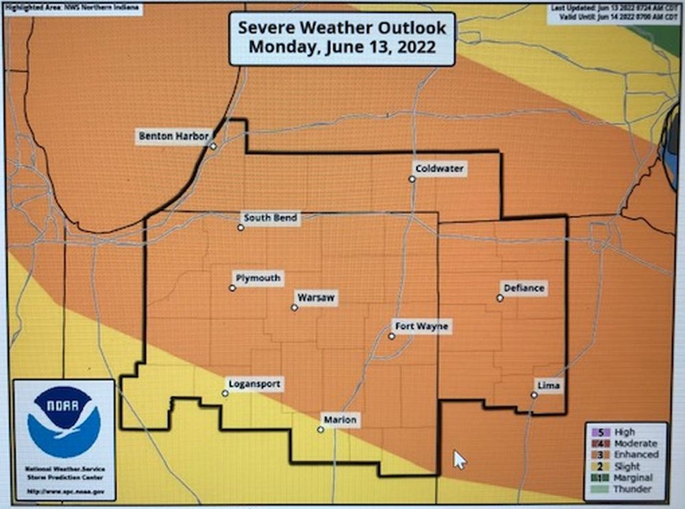
The National Weather Service Storm Prediction Center has moved us into the “Enhanced” Risk of Severe Weather (3 out of 5) since the first SitRep was sent out this morning.
THREAT: Two rounds of severe weather may be possible between 1pm – 5pm. The best chance will be late this evening into tonight. Damaging winds of 70+ MPH are the main threat, but hail, flooding, and isolated tornadoes are all possible.
IMPACT: Strong winds or tornadoes may damage structures, bring down trees or tree limbs which could cause damage to powerlines leading to power outages. Heavy rain could cause flash flooding, flooding of low-lying areas and areas that are prone to flooding during heavy rains. Downed trees or tree branches may also impact travel. Concerns remain regarding power outages during the extreme heat which may increase the number of heat related illnesses and calls for medical attention.
PREPAREDNESS ACTION: Check your emergency kit. Charge your cell phone and be sure to check you flashlights and lanterns. If you must drive at night, be mindful of downed trees across roads as they may be difficult to see. Never touch downed power lines as you have no way of knowing if they are energized or not. If you live in an area that is prone to flooding caused by heavy rain, be prepared to move to a safer location.