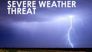
 Then National Weather Service Storm Prediction Center has placed Marshall County in the “Slight Risk” category for severe weather Tuesday afternoon & evening caused by the remnants of Tropical Depression Cristobal.
THREAT: Strong to severe thunderstorms with wind gusts that could reach 40-60 mph. Tornadoes are also possible.
IMPACT: Damage to trees, may lead to downed powerlines which could cause power outages. Trees across roads or into buildings. Loose objects could be blown around and cause damage as well.
PREPAREDNESS ACTION: Secure loose objects outdoors that can be blown around and cause property damage. Never touch downed powerlines. Check batteries in flashlights to be sure they are working properly. Monitor local news for weather updates and be prepared to take shelter should severe weather threaten.
Reminder: When the Tornado Siren is activated it will emit a continuous tone for an extended period of time. Sirens were designed to alert people outdoors to seek shelter indoors. Outdoor warning systems cannot always be heard by people inside a building and it is highly recommended that you have an alternative method of receiving severe weather alerts, such as on your smart phone, NOAA Weather radio or by monitoring your local news channel.